29th Sep, 2023 10:30 GMT/BST
Books, Maps & Manuscripts


95
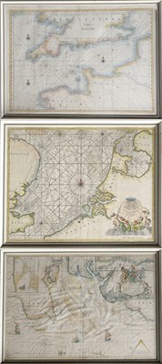
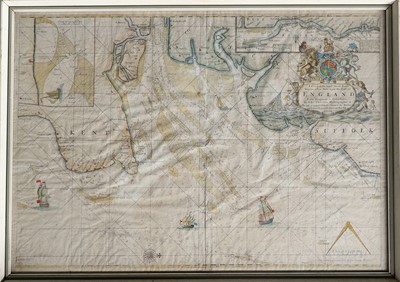
Thornton (John) and Mount (Richard).
A Chart of the Sands, Shoals, Buoys, Beacons and Sea Marks upon the Coast of England from Dengeness to Orfordness.
No date, 'Corrected this present year 1688, By the Trinety Masters' printed under scale, hand-coloured engraved sea chart, image 523mm x 740mm, white residue to small area head of centre fold, framed and glazed;
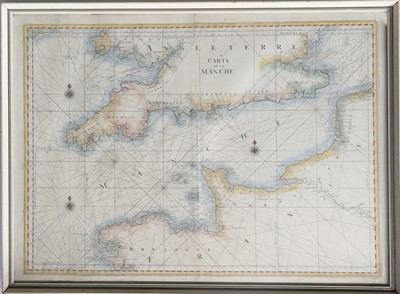
English Channel, Carte de la Manche.
No date, anonymous hand-coloured engraved sea chart, possibly after Sanson/Jaillot, plate mark 600mm x 828mm, framed and glazed;
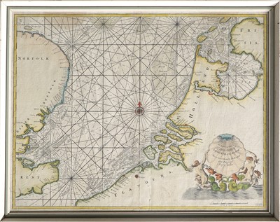
Collins (Capt. G.), [The southern North Sea]
No date [1693 added to lower corner], hand-coloured engraved sea chart of area between East Anglia and Holland, plate mark 457mm x 578mm, framed and glazed. (3)
Sold for £110
Estimated at £150 - £250
Auction: Books, Maps & Manuscripts, 29th Sep, 2023
Highlights include a Late Medieval Prayer Book; a Monograph of the Trogonidae, or Family of Trogons, by John Gould, (1875), with forty-seven superb hand-coloured lithographic plates; an outstanding early album of Austrian topographical woodcuts and watercolours; a fascinating album of late 19th century photographs of Brisbane, Queensland and surrounding areas; the first part of the York library of Hugh Murray, author and historian; a collection of vintage playing cards and a large folding map of India.
Viewing
Thursday 28 September 10am-5pm, and morning of sale from 8am
Sell one like this
If you've got a similar item to sell, complete the valuation form below and one of our experts will get in touch.

